
View Mikulov (Nikolsburg) via
JewishGen Resource Mapping or
Google Maps
(Latitude 48°48´, Longitude 16°38´)
then click your browser's "Back"
button to return to here
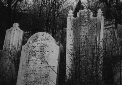
Nikolsburg, strategically situated half way between the Habsburg imperial capital of Vienna and the main Moravian city of Brünn, lay just inside Moravia on a major trading route. When Czechoslovakia became independent following WWI Nikolsburg was renamed Mikulov. Jewish life here reached a peak in the early 19th century, outshining other towns in Moravia. Jews benefitted from the relatively benign regime of the Prince von Dietrichstein family, and a thriving community developed on the western slopes of the imposing hill on which stood the princely palace. Nikolsburg, the seat of the Moravian Chief Rabbi, had a well-known Yeshiva, many synagogues and a large graveyard in which many of the famous rabbis of Moravia are buried. Mikulov was part of the Sudetenland which was handed over to Hitler by the appeasers at Munich in 1938. Those who didn't escape died in the concentration camps.
|
Copyright © 2022 Updated 07 Jan 2022 |
This site is hosted at no cost by JewishGen, Inc., the Home of Jewish Genealogy. If you feel there is a benefit to you in accessing this site, your JewishGen-erosity is greatly appreciated.